
The Land Between Two Rivers: Geography of Southern Mesopotamia
The First Known Civilization 4500–1900 BCE Article 2

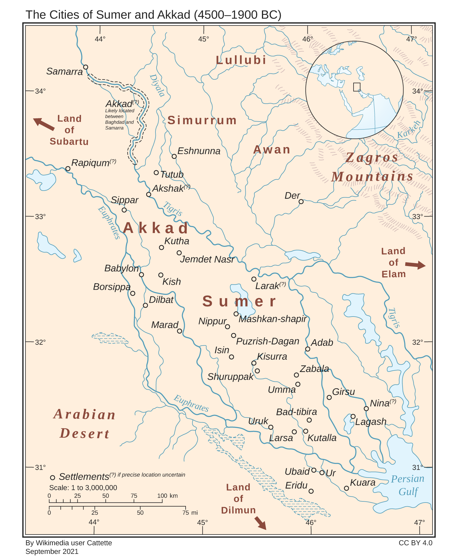
The story of Sumer begins in a land shaped by rivers, clay, and seasonal floods. Southern Mesopotamia—literally "the land between the rivers"—formed the geographical foundation of the world’s first civilization. Located between the Tigris and Euphrates Rivers in modern-day Iraq, this region did not possess forests, metal ores, or stone. Yet it birthed agriculture, cities, writing, and kingship. Understanding the geography of Sumer explains how the environment directly shaped every aspect of Sumerian society.
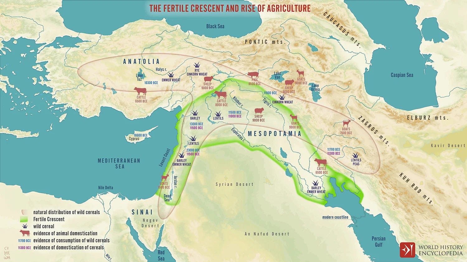
The Fertile Crescent and the Birth of Civilization
The southern tip of the Fertile Crescent was home to ancient Sumer. Unlike the northern regions of Mesopotamia, where rainfall could support crops, Sumer had an arid climate with minimal rainfall (less than 150 mm annually)[1].
Instead, its fertility came from seasonal floods that deposited rich silt across the riverbanks, forming the only environment in the world at that time where large-scale irrigation farming could thrive without rainfall[2]. The rivers, however, were unpredictable. Floods could be destructive or mistimed, requiring technological innovation to control them.
The Role of the Tigris and Euphrates Rivers
The Tigris River flowed faster, had a steeper gradient, and flooded violently. The Euphrates flowed more gently but shifted course frequently[3]. This duality created both a challenge and a blessing: the Sumerians had to develop canals, dikes, and levees to manage these rivers.
Irrigation canals dug by hand diverted water during flood seasons, while dikes held back overflow. Levees helped prevent catastrophic breaches. The first known large-scale canal networks in Sumer were built as early as the Ubaid period and expanded through the Uruk and Early Dynastic periods[4]. These irrigation systems allowed the Sumerians to transform marshy floodplains into productive farmland.

Keep reading with a 7-day free trial
Subscribe to VEINS OF TRUTH to keep reading this post and get 7 days of free access to the full post archives.